Everest Base Camp Trek
The trek to Everest Base Camp is a classic journey that ranks among the most popular in the world. It is reliably estimated that 40,000 people embark on the trek every year. This ranks it higher in popularity than Mount Kilimanjaro which sees 30,000 climbers per year and in the same ballpark as the famous Rim-River-Rim day hike in the Grand Canyon.
Justifiably one of the most popular treks in the world…
Why this great popularity? There are three main reasons:
- The Roof of the World—There is no place on Earth like the Himalayas and no place in the Himalayas like at the foot of the world’s tallest mountain. One look at the Khumbu Icefall and the terrifying vastness that rises two vertical miles above it amply pays the price for the days of hard work it takes to get there. The very thought of Mt Everest evokes powerful memories of the pioneers who first came to contend with the mountain. Being there at its foot makes history come alive and gives the visitor a sense of how remarkably mad it was for them to wonder: “Will it go?”
- Kathmandu—To get to Everest Base Camp a visit to Kathmandu is a necessary part of the itinerary. Kathmandu! Who hasn’t heard of it and wondered what it is like? Just the name has an exotic quality that is irresistible. This anteroom to the roof of the world is an adventure traveler’s dream come true. From the giant Buddhist temple of Boudhanath to the public cremation fires along the Bagmati River there are sights, sounds and smells like no other place in the world.
- Just tough enough—The journey to Everest Base Camp is difficult but well within the grasp of any fit traveler. The “x” factor is altitude and your ability to adjust to it. There is absolutely nothing technical about the trip and no traditional mountaineering skills are required. Anyone with a good pair of boots and ability to walk, mostly uphill, for four to six hours a day can take on the challenge. While there will be moments of exhaustion and doubt for everybody, these are what (in retrospect!) make the trek such an incredibly rewarding experience.
I did the trek in September-October of 2019 and what follows is a record of that journey along with a few logistical observations.
Getting to the Starting Point
From Kathmandu it is about 85 air miles to Lukla, the starting point for all Everest Base Camp treks. Currently, the only ways to get to Lukla are by air or on foot. A road is in the works but is probably at least two years from completion. When finished it will be an important commercial link for the shipment of goods into the Khumbu region but probably not attractive to travelers. Few will find a 12-hour bus journey on a dirt road worth the cost difference versus a 30-minute $185 flight.

However, lots of people may want to consider the two flight options that are currently available: airplane and helicopter. One look at Lukla’s Tenzing-Hillary Airport explains everything. The runway is breathtakingly short (1,729 feet / 527 meters) and is constructed with the edge of a cliff on one side and a very solid mountain on the other. Planes land just beyond the edge of the cliff and use the steep uphill slope of the runway to slow down. That they do this many times a day during the trekking season is a testament to the pilots’ remarkable skill. For some trekkers, living to tell the tale of landing at Lukla is an indispensable part of the Everest Base Camp experience. Whether fairly or unfairly, Lukla is widely celebrated as “The World’s Most Dangerous Airport” and anyone who lands there in a fixed wing aircraft will have tales to last a lifetime.

By contrast, the helicopter option provides an expensive but thoroughly relaxing way to get to the same place. The pace is slower (45 minutes in the air), the views are better, and the landing will not rattle anyone’s back teeth. No one will come away from a helicopter flight to Lukla without an appreciation of how perfectly suited helicopters are to travel in this car, truck and road-less part of the world.
Where can I stay, what can I eat?
From Lukla to Gorak Shep and everywhere in between there are lodges, hotels, teahouses and restaurants that offer rooms for the night and all the food and drink that a traveler could possibly wish for. Nobody needs to lug a tent or stuff the backpack full of freeze-dried meals.
Prices along the way are incredibly reasonable.
The ready availability of bottled water means that filters, purifiers and chemicals can be left at home. Moreover, the sheer abundance of choices means that competition is fierce and prices very low. A trekker who wants to travel independently can easily get by for under $40 per day.

Choices, choices, choices
Literally dozens of adventure travel companies offer trips to Everest Base Camp. For as little as $1,000 you can buy a spot with a company that will arrange air transportation to Lukla and provide a local guide for a group of a dozen or so travelers. Accommodations will be at the same basic standard as for those travelling independently but you will have the safety net of a guide who knows the route and makes informed choices on where to eat and stay for the night.
On the other end of the spectrum, several companies offer “Luxury Everest Base Camp Treks” for prices ranging between $5,000 and $11,000. These promise helicopter transportation, private rooms in the best hotels the region has to offer, elaborately equipped campsites where no luxury hotels are available, guides with emergency medical training and equipment, high-quality food geared to the trekker’s taste and an army of cooks, porters and facilitators to make life on and off the trail pleasant. While a luxury trekker will have to hike the same number of miles to Everest Base Camp as everyone else and mount the same hills, he will do so with less weight in his pack (spare clothes, sleeping bags, etc. will be carried by porters) and he will get back to Kathmandu a couple of days early. This is because the return from Base Camp will not require a walk all the way back to Lukla. The helicopter will provide a high-altitude pick-up from Dingboche, Lobuche or Gorak Shep and effortlessly whisk luxury travelers back to the city.

What is the trail like?
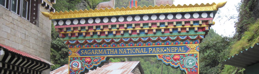
In general, the trail is absolutely topnotch and equal to almost anything in the United States National Park system or Europe. The Nepali government knows that the trail and Sagarmatha National Park are national treasures that require protection and careful maintenance. The trekking industry provides thousands of jobs and is a vital source of hard currency. In order to assure that trekkers have a positive experience the government invests continuously in upkeep and new bridge and step-building projects. While hiking, not a day will go by that you will not see crews of stone masons busily at work improving the trail.

Naturally, as with any wilderness trail, the forces of nature are always at work trying to undo the builders’ efforts. Particularly in the sections of trail that cross glaciers or follow lateral moraines there are bound to be recently disturbed areas that make the going difficult. However, these are remarkably few and far between. To anyone who has read the stories of the hardships endured by the early climbing parties that made their approach to Mt Everest (raging rivers to ford, leeches dropping from nowhere onto any patch of exposed skin, treacherous muddy trails skirting precipices, and so on) the tamed and civilized current nature of the trail will be a revelation. I was frankly astonished at the quality of the trail.
The Everest Base Camp Trail is among the best constructed in the world.

Altitude, the Silent Adversary
For many trekkers, the trip to Everest Base Camp will be their first high altitude experience. Here is the number of them who will enjoy the effects of high altitude: -0-. It is amazing that altitude can make a supremely fit athlete feel like he has instantly gained 20 pounds and become a 2-pack-a-day smoker. The reason is simple: we humans like oxygen and there is less and less available the higher you go. This is not to say that the composition of the air changes. You will find the same 21% portion of oxygen in the air at the summit of Mt Everest as you will at sea level. However, air has weight and the column of air above you weighs less the higher you go. Less weight means less pressure squeezing the molecules of oxygen together. The friendly, close-packed group of oxygen molecules you have at home becomes a distant, aloof group of loners at altitude. By the time you reach Everest Base Camp, you will be breathing approximately half the oxygen that you are used to.

Acclimatization is the process that ameliorates the effects of altitude. It is mainly a matter of adjusting the blood chemistry to the new conditions. Red blood cells carry oxygen and white cells don’t. In the acclimatization process the body manufactures more red cells and a chemical that facilitates the release of oxygen to the muscles. Over the course of the first few days of the trek this buffers the shock of the altitude change and most people will feel less awful. However, no one should expect his or her performance to return to “normal.” With less oxygen available you will swiftly go anerobic if you attempt to hike at anywhere near the pace that you are comfortable with at home. To survive and enjoy the trek you will have to go S-L-O-W. If you can average a 1 mile-per-hour pace you are doing wonderfully well. Discipline is required if you want to get to the 17,598 foot / 5,364m finish line. Remember, no one in your life is ever going to ask you how long it took you to get from Lobuche to Gorak Shep!
Remember, no one in your life is ever going to ask you how long it took you to get from Lobuche to Gorak Shep!
Bear this in mind and you will successfully survive the worst that altitude can throw at you.
A Word on Names
All the names of cities, towns, monuments and people in the region are properly rendered only in the Nepali language. Unfortunately for the Western traveler, that language uses a script that is not based on our ABCs. The anglicized version of Nepali names often offers two or more possibilities, each of which is equally correct. For example, the man’s name “Tsering” can also be recorded as “Chhiring” and the famous town of “Thukla” can equally be written as be “Dugla.” I have used the variants that seem to be most common.
Expedition Trip Report
Arrival at Kathmandu and Preliminaries (September 27-28)
After a 7-hour flight from Istanbul, I arrived at Kathmandu’s Tribhuvan International Airport (“KTM”) at 6:30am. Mine was the first flight of the day into the airport and at that sleepy hour the place was uncharacteristically empty. I had been to Kathmandu once before 17 years earlier to stage for a climb of Cho Oyu and the airport was exactly as I remembered it—scruffy, ill lit and faintly chaotic. It was the perfect place to start of an adventure travel experience! The only thing different was the absence of jostling crowds.
Tribhuvan International Airport is a wonderful gateway for trekkers.
Passport Control is a bit slower at KTM than most other international airports because it is done in two steps. First you go to the Visa Desk and get your 30-day Tourist Visa ($50 payable in cash only). Second, you bring your visa paperwork to Passport Control itself. In a time-consuming process that all frequent travelers to developing countries are familiar with, the passport officer manually fills out some obscure paperwork and eventually attaches an adhesive-backed Visa to your passport. In these modern days when you can travel to every country in western Europe without anyone ever so much as putting a stamp in your passport it is a genuine thrill to visit a place where you bring home irrefutable proof of having been there.

One tip: You can save a lot of time at the Visa Desk if you apply for a Tourist Visa online before you leave home. Although online payment is not possible and you will still have to hand over $50 in cash, you will be able to upload a recent photo of yourself and thus avoid the need to bring a print photo or use the “selfie” booth at the airport. The Nepal Department of Immigration website where you can fill out the visa form is here.
After collecting my luggage, I exited the terminal building and found my guide, Tsering Wangchu Sherpa, waiting to say hello and bring me to my hotel. Tsering is about 40 years old and has lived in the Khumbu region of Nepal all his life. His home is in the town of Khunde, a couple of hours north of Namche Bazaar. Besides guiding for Adventure Consultants, he runs a popular teahouse in Khunde. A polylingual with a rare combination of language skills, Tsering is as happy to talk to you in English, Japanese or Hindi as he is in his native Nepali. Tsering specializes in trekking expeditions. He has guided Everest Base Camp trips numerous times and also the 20,000 foot / 6,100 meter “trekking peaks” that everywhere else but Nepal would be considered major summits. A family man, he says that the risks of the 8,000 meter giants do not appeal to him. After dropping me off at the hotel, Tsering went back to the airport to await the other member of our team who was arriving later in the morning. We arranged to meet at the hotel for a gear check at 5pm that evening.

I was excited to be staying at the fabled Yak & Yeti Hotel. Tucked away at the end of a twisty and distinctly unpromising side street, the hotel is an oasis of old-world luxury in a city whose defining characteristic is hectic, freewheeling disorder. The 25-minute, 5 mile (8 km) van ride from the airport was all that it took to reassure me that Kathmandu had lost none of its crazy vibrancy since my last visit. However, this made me all the more grateful for the tranquility the Yak & Yeti provides. Once installed in a guest room overlooking the pool and a garden abounding in beautiful jacaranda trees I was happy to find the high speed internet and satellite TV link working just fine. Cell phone coverage is likewise excellent throughout the city and, as I later found, in many areas along the trekking route. To avoid high cell phone roaming charges you can buy a pre-paid SIM card while in Kathmandu and pop it into your phone. The only caution is that your phone must be “unlocked” and capable of operating on a CDMA network.

I met Mike, my fellow Adventure Consultants trekker, in the lobby of the hotel. He is a fit and outgoing guy with numerous Ironman Triathlon finishes to his credit, including the mother of them all in Kona, Hawaii. He owns the Mercedes Benz dealership in Dothan, Alabama and a group of other new and used car sales and repair facilities. He is the former two-term mayor of Dothan and now is chairman of the public school system there. All his impressive public service has been done for no pay as his way of giving back to the community where he got his start in business and raised his family. After doing the Everest Base Camp Trek he is thinking about trying to swim the English Channel!
To round out the introductions, I will add a couple of words about myself (Tom). I am a merchant banker from the very hot and completely flat city of Houston, Texas. I have done a bit of mountaineering throughout the world and a couple of years ago completed the Polar Trilogy which involves cross country skiing to the North Pole, South Pole and across Greenland. The trek to Everest Base Camp has been on my must-do list for years.

After completing the gear check with Tsering (Mike’s and my stuff was in good order) we rounded out our first day in Kathmandu with a nice dinner. At dinner, Tsering mentioned that it was highly unusual for treks to have just two clients on them. Apparently, others had been scheduled to come but dropped out short of the starting gate. We were grateful to New Zealand-based Adventure Consultants for running the trip despite the short client list. As we were soon to find out, Mike and I would have 10 people looking after our needs for the duration of the trek. This is the extraordinary level of service Adventure Consultants provides its Luxury Everest Base Camp Trek participants.
During the trek not a day went by that I did not thank my lucky stars for having checked the AC “Luxury Trek” box!
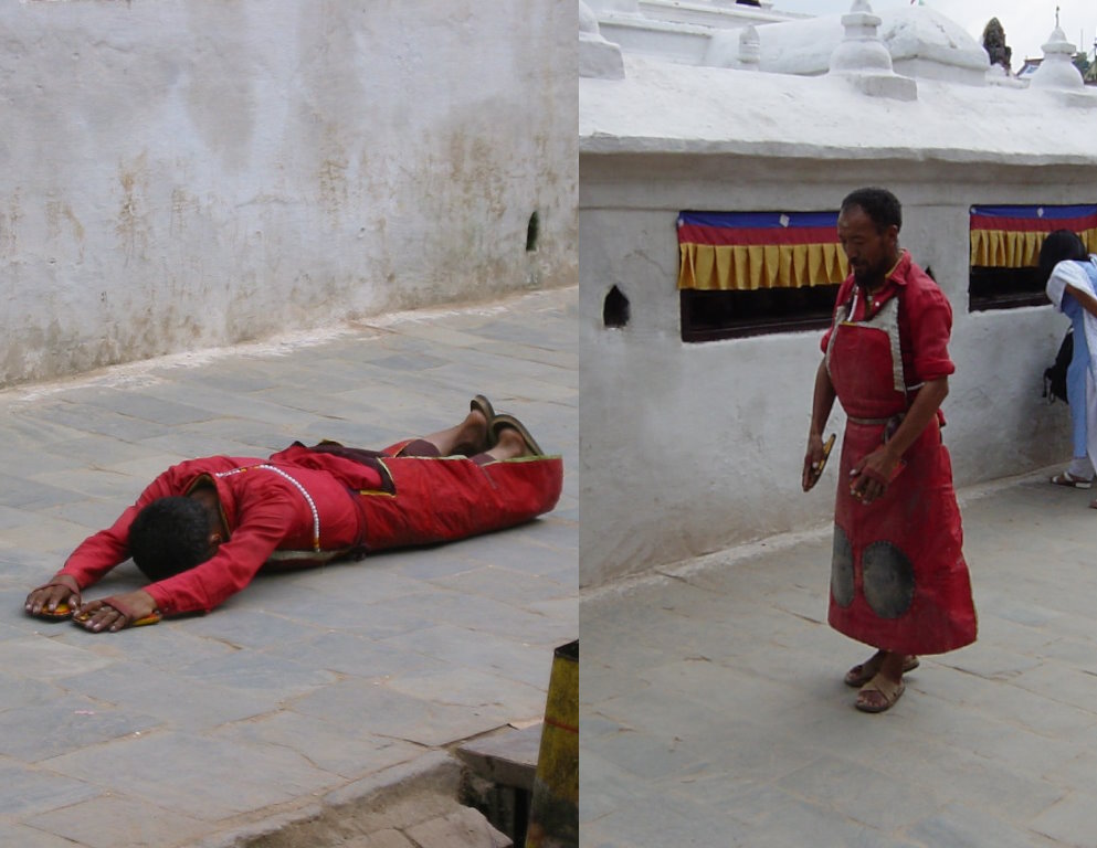
After the arrival/gear check day the itinerary provided a full day for us to explore Kathmandu. We visited the Boudhanath stupa first and it is wonderfully impressive with “wisdom eyes” surveying the city from all four points of the compass. It is a pilgrimage site for Buddhists from around the world. We saw one such pilgrim who had come from far away prostrating himself after every step. His ragged leather apron and the well-worn wood blocks he used to protect his hands gave testimony to a long and arduous journey. Surprisingly for so large a structure, there is no interior to explore at Boudhanath. The great stupa is completely solid. With thousands of butter lamps always burning and infusing the atmosphere with their heavy odor, the chanting of priests and the colorful riot of prayer flags everywhere it is a place that must be experienced to be appreciated. As is the rule for all Buddhist religious monuments, you are expected to pass to the left of it or circle it clockwise.

After Boudhanath, our guide brought us to the famous Hindu shrine of Pashupatinath. Until recent years, Hindu was the official religion of Nepal and the temple complex is large and sprawling. It was crowded with colorfully well-dressed worshippers. The Bagmati River flows through the complex and is the stage for the cremations that take place there every day of the week. When we arrived, preparations were underway for the cremation of an important personage, a judge according to our guide.

Bright orange garlands adorned a stone platform stacked with wood for the funeral pyre. Family members attended the white-wrapped body on a ramp that descended to the fast-flowing river. Directly opposite, on the other side of the narrow river, tiered stone galleries provided seating for hundreds of onlookers. Despite the somber occasion the mood of the crowd was respectfully cheerful. There were few westerners and it seemed clear that for most spectators these cremation rituals were a common part of life. We departed just before the deceased was placed on the pyre and its fires lit.

To round out the sightseeing part of trip, I took a tour of the former royal palace while Mike did some last-minute shopping in Thamel. When I last visited Nepal in 2002 the monarchy was still in place but teetering because of a Maoist insurgency and a massacre that happened within the palace walls a few months before. The massacre was perpetrated by a drunk crown prince who allegedly was unhappy about royal opposition to his marriage plans. The “allegedly” qualifier in the last sentence is due to the fact that no one really knows what inspired the violence. The whole affair was covered up and the killer allegedly died by his own hand. Ten members of the royal family perished in the attack, including the king and queen. The clumsy cover-up put a spotlight on the privileges of the surviving royals and the monarchy was formally ended in 2008.
A strangely uninviting palace!

It was interesting to tour the so-called Narayanhiti Palace and glimpse what life was like there in its heyday. Surprisingly, it is a cold and graceless place wholly lacking in luxuriousness despite its large (40,000 square feet / 3,700 square meters) size. If popular envy of the royal lifestyle was a factor in the monarchy’s overthrow, the king should have opened the palace doors to the public years before to show how the royals really lived. Personally, I was happy to get back to the Yak & Yeti where the comforts were of a more modern vernacular.
Trek Day #1(September 29):
Lukla (9,255’ / 2,821m) to Monjo (9,673’ / 2,948m)
Trekking distance: 8 miles / 12.9 km
Net altitude gain: 418’ / 127m
True hills climbed: 3,251’ / 991m
Hours on trail: 6:20:00
We left the hotel for the airport at 5:45am. The day was cloudy and I was very apprehensive about what we had in store for us. Per the schedule, in our first day on the trail we would have our biggest mileage day and climb hills that cumulatively gave us the biggest hill-climbing total of the entire trip. On top of this, the helicopter would vault us from Kathmandu’s 4,386 feet / 1,337m altitude to Lukla’s 9,255 feet / 2,821m. As any experienced climber knows, gaining a mile in altitude in one day is a tall order.
Kathmandu’s streets were relatively empty on the ride to the airport and this made the chaotic nature of its communications infrastructure vividly apparent. Every power pole was thickly festooned with hundreds of telephone, cable and other wires. Apparently, every subscriber gets his own cable from the street to his home. The result is a tangle of Gordian proportions. I made a mental note to never grouse about the utility poles in Houston ever again.

By the time we arrived, KTM’s domestic terminal was seething with activity. However, rather than having to wait on the long check-in lines we were ushered to the charter helicopter desk. We and our gear were carefully weighed and were soon taken to the tarmac for a van ride to the helicopter flight line. We hopped aboard the Airbus H125 copter and at 7:30am began the flight to Lukla. Regrettably, it started to rain the moment we set off and our views were greatly obscured. Because we had to dodge cloud banks along the way it took almost a full hour to get to Lukla. The rain was pouring down when we landed.

Immediately after getting off the helicopter, Tsering introduced Mike and me to Sonam, the assistant guide, and Bobby and Kanchha, our two porters. We quickly walked a short distance to a teahouse (the Sunrise Lodge) in Lukla-town to have breakfast and hope for improvement in the conditions. We loitered for over an hour at the teahouse and it was very pleasant to chat over coffee and muffins there. We learned that Sonam had just started his guiding career a few months before and that Tsering thought the world of him. Sonam was in his early twenties and was working hard to get his English language skills up to snuff. Sporting jeans and casual wear rather than hard-core trekking clothes, he would have been indistinguishable from any other fashionable young twenty-something if dropped off in the middle of Los Angeles or Houston. As we were soon to learn, he has an uncanny sense of direction and ability to set a perfect trekking pace. He made a very favorable first impression.
Sonam proved to be an outstanding guide and pacesetter.

We did not have much opportunity to converse with the porters. Rather than staying with us, Tsering gave them their loads and sent them off to Monjo ahead of us. They started the trip with relatively light loads (65 pounds / 30 kg) but by the time we passed Dingboche their burdens were considerably higher. I was incredibly grateful that all I had to worry about was a 15 pound / 7 kg day pack.

It was raining steadily when we left the teahouse but I found the hiking very pleasant. The main reason was that the trail points mostly downhill for the first 5 miles / 8 km of the journey. The second happy revelation was that the trail is marvelously well constructed. Going downhill on a good trail allowed us to get our legs underneath us and banished the jitters. Our order of march, which we maintained throughout the thirteen days of the trip, was Sonam first followed by me, Mike and Tsering in that order. Towns came and went along the trail and we crossed the first of the many suspension bridges on the route. We plowed on for three hours before taking our first break. We could have chosen any of dozens of teahouses to stop at and each one of them looked welcoming and bright. Refreshed by plenty of good coffee and lunch we tackled the final 3 miles / 5 km of the trek to Monjo with renewed spirits. However, we knew that the we would have to regain all the altitude we lost while going downhill and the route would be steep and tough.

Before coming to Nepal, I plotted each day of our trip in Google Earth to get a sense of distances and altitude gains. It was abundantly clear from this exercise that the route is loaded with areas where precious hard-won climbs are erased by long descents. The up-and-down nature of the trail is perfectly captured in the Google Earth “Elevation Profile” view. Thus, I knew that even though our hike from Lukla to Monjo would give us a modest 418 foot / 127m net altitude gain, to get that gain we would have to climb 3,251 feet / 991m worth of hills.
In our first day on the trail we would have to do the greatest number of miles and most hill-climbing of the entire trek!
The rain stopped sometime before lunch and our final three hours on the trail were done in more agreeable conditions. However, it was no easy matter to ascend the final 2,500 feet / 762m into Monjo. One of the things that saved us was that the route followed the course of the Dhudhi Kosi River and it was wonderful to see it churning its way towards the distant sea. In Nepali “dhudhi” means “milk.” Anyone seeing the white-foaming mass of the river would agree that it is aptly named. We finally arrived at our destination at 4pm and it was incredibly rewarding to have our first day on the trail behind us. Our feeling of well-being was reinforced by the fact that our hotel (the Everest Summit Lodge) was very nice indeed. On entering we were welcomed with tea and cake in a cheery warm dining room and afterwards were taken to large private guest rooms complete with showers and big comfortable beds. While there was no mistaking that Mike and I were both feeling the effects of being at nearly 10,000 feet / 3,048m, the prospect of dinner and a good night’s sleep were very encouraging. As far as I was concerned, the part of the trip that I had most worried about was over. I was confident that the rest would unfold equally well.
Trek Day #2 (September 30):
Monjo (9,673’ / 2,948m) to Namche Bazaar (11,313’ / 3,448m)
Trekking distance: 3.6 miles / 5.8 km
Net altitude gain: 1,640’ / 500m
True hills climbed: 3,239’ / 987m
Hours on trail: 3:30:00
Following a great 7am breakfast, we got underway at 7:45am with a predicted arrival time in Namche Bazaar of five hours later. In the event, we easily made the distance in three and a half hours and along the way experienced the Everest Base Camp Trail at its finest.

A ten-minute walk from the hotel brought us to the entrance to Sagarmatha National Park. There Tsering did some paperwork and paid our entry fee. The route started with a sharp descent before leveling out as it tracked the Dhudhi Kosi. After about 1½ miles / 2km we spotted a spectacular pair of suspension bridges in the distance. The bridges are stacked with the higher one 230 feet / 70 meters above the river’s surface and the lower one about 50 feet / 15 meters below and in front of it. These are the Larcha Dovan Footbridges. The higher bridge evidently was installed as a replacement for the lower one which is now disused. To ascend to the high bridge there is a series of beautifully constructed stone stairways and ramps, the quality of which is equal to anything I have seen on a hiking trail anywhere in the world. It was a genuine thrill to step out onto the airy bridge and see the river thundering below. It is apparent that a lot of careful engineering went into the construction of the bridge because it is stable and robustly built. I have heard that it terrifies a lot of people but honestly for anyone who is not a genuine acrophobic it poses no problems at all.
Sagarmatha National Park is a true national treasure for Nepal.

Once over the Larcha Dovan Footbridge the route tracks relentlessly uphill. Lightly loaded with just our daypacks Mike and I had no trouble at all. However, my heart went out to the scores of immensely burdened porters we encountered along the way. The weather was fine and this brought out large numbers of them who had been delayed by yesterday’s stormy conditions. The loads the strongest of them were carrying were perfectly unbelievable. According to Tsering, an ambitious porter will carry a load of 150 pounds / 68kg. Since they are paid based on weight and distance many go beyond what seems humanly possible to maximize their income. Rather than using high-tech backpacks, the porters employ traditional wicker baskets and suspend the load with a head strap called a “namlo.” The most hard-core of these load carriers are distinguished by the short “T” shaped stick that they tote. The stick is used to prop up the load and relieve the porter’s body of its weight during rest breaks. It allows them some comfort without the need to dismount the load entirely and risk not being able to take it back up without assistance. Scientists have puzzled over the remarkable load carrying ability of Nepalese porters for years, thinking that they must have some “trick” that allows them to do what they do. A peer-reviewed analysis published in the Journal of Experimental Biology in 2016 concludes that there is no trick at all. The porters are simply strong, motivated and inured to hard work.

Emerging from the woods and first spotting Namche Bazaar was a great moment. The town is spread up and across a steep, crescent-shaped hill and from the distance you can see almost all of it at once. It is a bustling place with about two thousand full-time residents and a wonderful array of shops, restaurants and bars to attract trekkers. It is a miniaturized version Kathmandu’s thriving Thamel shopping district. Tsering was literally in his own backyard in Namche and effortlessly led us through its warren of narrow stone-paved streets to our hotel, the Khumbu Lodge Apartment.
Tsering knew Namche Bazaar as only a person born in the Khumbu could.
Just like the hotel we stayed in the night before, this one featured large comfortable private guest rooms with all the necessary amenities. Mine was a third-floor walk-up that had a wonderful view of the city and the lushly treed mountains on the other side of the valley. It is interesting that in Nepal the tree-line is much higher than in the United States. In America trees commonly are gone by the time you reach 11,000 feet / 3,353m. Here they still grow strongly on terrain a couple of thousand feet higher. Although the trees were thriving at Namche Bazaar’s altitude and Mike and I were doing reasonably well, there was no mistaking that the air was getting painfully thin. After lunch at a restaurant in town I returned to the hotel and did my usual sprint up the stairs. Bad idea! By the time I reached the third floor I was gasping for breath. I was happy that tomorrow was a scheduled rest and acclimatization day.
Trek Day #3 (October 1):
Namche Bazaar (11,313’ / 3,448m) Acclimatization Hike
Trekking distance: 1.3 miles / 2.1 km
Net altitude gain: 601’ / 183m
True hills climbed: 601’ / 183m
Hours on trail: 3:00:00
We had a light schedule for our acclimatization day in Namche Bazaar. After a pleasant 8am breakfast in a private dining room at the hotel, Tsering proposed that we hike up the hill to the Sagarmatha National Park Museum. He said that the museum itself is not worth visiting but that the views from its grounds are spectacular.
Unfortunately, by the time we reached the Museum, clouds had rolled in to block the view entirely. We contented ourselves with the assurance that on a better day we would have been able to see Lhotse, Lhotse Shar and Everest standing proudly above the surrounding mountains just 17 miles / 27km away. All was not lost, however. There is a wonderfully exuberant statue of Tenzing Norgay at the site and it was great to be able to pay our respects to the great mountaineer and reflect on his accomplishments. Tenzing was the original Sherpa “tiger” who will forever be the model for all Sherpa mountaineers who follow him.
Ironically, the Tenzing statue tells everyone “Do not climb!”

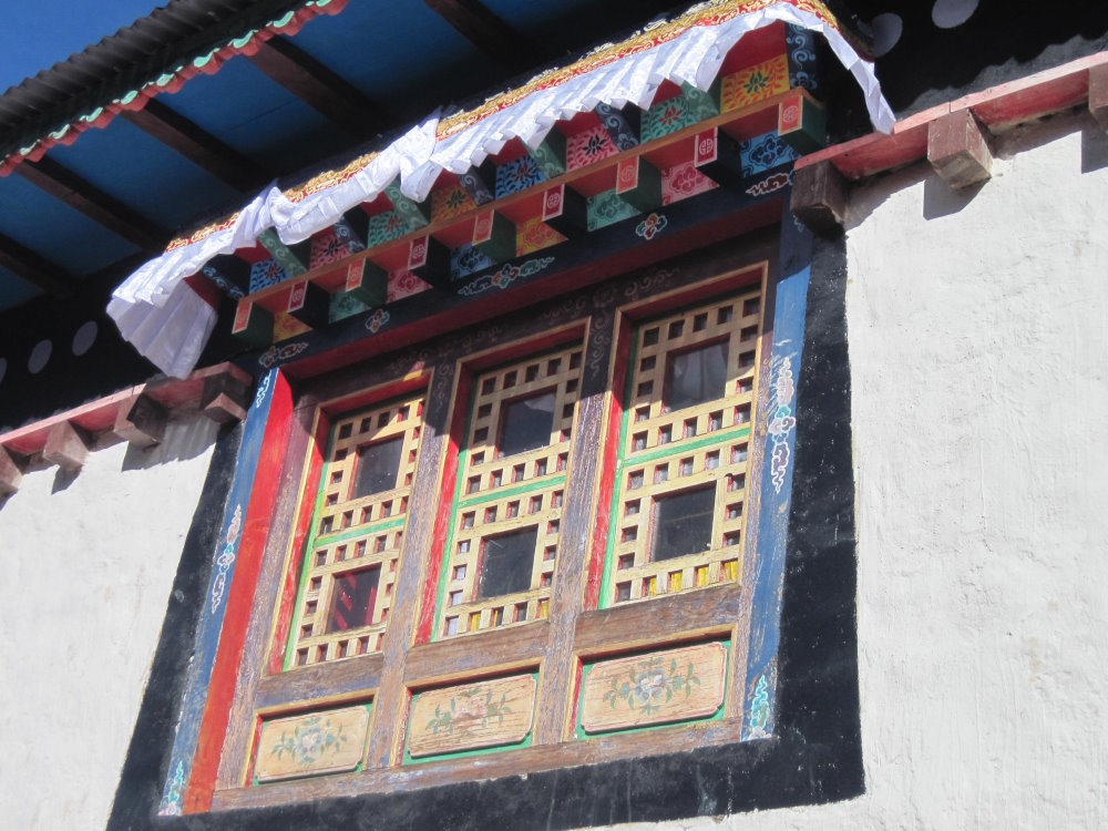
On the way back down the hill we visited the Sherpa Culture Museum and toured the traditional Sherpa house there. It features a livestock barn on the first floor and a cozy second floor apartment for the owners. Kitchen, storeroom, Buddhist shrine, dining room and bedroom are all within one 350 square foot / 33 square meter space. It takes “open plan” design to its limit because there are no partition walls at all. Tsering ably described its features to us and said that he himself was raised in a house much like it.
We got back to the hotel in time for lunch and afterwards I did a little shopping around town. There is a tremendous variety of goods on offer and I had no trouble finding an iPhone power adapter to replace one that had gone missing. In addition, any number of ATMs are available to meet anyone’s cash needs. Both Mike and I took advantage of the ATMs to get the money we needed to pay tips at the end of the trip. We both felt very rich holding inch-thick piles of Nepalese Rupees. What they lacked in inherent value they made up for in impressive bulk. However, our problems with wads of currency were nothing compared to what the Mt Everest expeditions in the early 1950s had to contend with. Sir John Hunt, the leader of the 1953 British expedition that saw Tenzing and Hillary reach the summit, reported that 17 porters were needed to carry the money necessary to pay the expedition’s retinue of 350 load carriers. Apparently, the local people hired to do the porterage were distrustful of paper money and demanded payment in coin. To meet this demand over 1,000 pounds / 455kg in coins were carried all the way from Kathmandu to the foot of Everest.
Trek Day #4 (October 2):
Namche Bazaar (11,313’ / 3,448m) to Tashinga (11,411’ / 3,478m)
Trekking distance: 4.9 miles / 7.9 km
Net altitude gain: 98’ / 30m
True hills climbed: 2,357’ / 718m
Hours on trail: 5:30:00
Today we took the road less traveled to get to our destination of Tashinga. Most parties head east out of Namche Bazaar towards the Park Museum grounds we visited yesterday before striking north to Tashinga. We initially headed west instead before taking a northward track. Our choice of route was prompted by three factors:
- It is far less crowded.
- It passes a monastery where we would see a genuine yeti scalp, and
- It goes right through the town where Tsering lives.
It is possible that the list above is not ranked by importance.
After our day of rest, Mike and I were immediately reminded that it is hard to walk uphill and that nobody gets to Everest Base Camp without working for it. What made the going bearable is that Sonam, who was leading our little train, is an absolute genius at setting a pace that we flatlanders can follow. I knew beyond a shadow of doubt that if left to my own devices I would have tried to race up the hill and made my life a living hell in the process. The disciplined, sensible pace which Sonam imposed was an invaluable shield against my own worst instincts. Both Mike and I had climbed Kilimanjaro and well-remembered the guides’ constantly repeated injunction, “Pole, Pole!” In Swahili it means “Slow, Slow!” and is understood everywhere in the trekking world. It was great to hear Tsering now calling out “Pole, Pole!” from the back of our line as an encouragement and caution.

After an hour of steep climbing we were 1,100 feet / 335m above Namche Bazaar and entered the small village that boasts the legitimately terrifying Syangboche Airport. Syangboche makes Lukla look like New York’s JFK airport by comparison. The runway is considerably shorter and steeper than Lukla’s and completely unpaved. On the morning we arrived it was ominously shrouded in mist and its neglected, threadbare facilities spoke volumes about the perils anyone daring enough to land there would assume. Despite this, Tsering said that until recent times the airport got a lot of use. Today the main traffic is from the ubiquitous Russian MI-8 cargo helicopters that you see in throughout the developing world.
Once past Syangboche, another half hour of steep climbing brought us to our high point for the day (13,000 feet / 3,962m) and the trail gradually tilted downhill. Over the next three hours we lost almost all the altitude we had so laboriously gained. However, it was undeniably pleasant to be walking downhill and we were excited at the prospect of visiting Tsering’s teahouse, the Mandala Home, for lunch. We arrived in Khunde village a little before noon and Tsering proudly led us to it. It is a very attractive place with a large wood-paneled dining room and adjacent wing providing rooms for overnight guests. Best of all, we got to meet Tsering’s wife and pretty sixteen-year-old daughter. His twenty-year-old son was the only missing family member. Tsering explained that the son was currently in Kathmandu training to become a member of the British Army’s legendary Gurkha Brigade.
When in Khunde village, stay at the Mandala Home!

After an excellent lunch at the Mandala Home, we hiked a half-hour down the trail to the Samten Choling Gompa, the centerpiece attraction of which is a yeti scalp. The gompa was an excellent place to visit because 1) who doesn’t want to see a yeti scalp? and 2) the interior is beautifully well-lit. I have visited many Buddhist monasteries over the years in Tibet and Nepal and it is always disappointing that the treasures inside are shrouded in darkness. Samten Choling was different in that its beautiful hangings and wall decorations all came to life under a modern array of electric lamps. It was a marvelously colorful display. We learned that the excellent modern lighting was the indirect result of the calamitous 2015 earthquake that devastated much of Nepal. The gompa was severely damaged by the earthquake and the lighting as added when it was rebuilt. Unfortunately, no amount of light could make the yeti scalp look more impressive than an inside-out fur mitten. Whatever yeti it once belonged to must have been a member of a very rare tribe of pygmy yetis.

Afternoon rain showers accompanied us on the remainder of our march to Tashinga but, well-built thing that it is, the Everest Base Camp Trail shed the water well and did not get muddy. We arrived at our hotel at 2:30pm and were immediately ushered inside for cake and warm drinks. The hotel is beautiful to look at and it was delightful to come in out of the rain to such an elegant welcome. Like the place we stayed in at Monjo, this hotel is part of the Everest Summit Lodge group and offers the best accommodations the region has to offer.
Trek Day #5 (October 3):
Tashinga (11,411’ / 3,478m) to Pangboche (12,945’ / 3,946m)
Trekking distance: 4.7 miles / 7.6 km
Net altitude gain: 1,534’ / 468m
True hills climbed: 3,055’ / 931m
Hours on trail: 5:30:00
We awoke to a beautiful sunny day and began our trek to Pangboche by taking what Tsering called the “old route” rather than the standard trail. Only someone with intimate local knowledge would dare to try it because it goes through a forest and has numerous splits and crossroads. It would be very easy to become lost and even Sonam had to occasionally ask Tsering which way to go. We lost about 600 feet / 183m in altitude in the first hour of the trek before joining the normal route and crossing the Dhudhi Kosi for the last time. Henceforth our river companion would be the Imjha Khola River which has its source at the great glaciers at the foot of Ama Dablam and Island Peak 7 miles / 11km east of us and Mt Everest 13 miles / 21km to the northeast.
Over the course of the next couple of hours we trekked straight uphill and finally arrived at the great Tengboche Monastery. The monastery is one of the largest in the Khumbu and is visited by many Everest climbers seeking a blessing before beginning their climb. Legend has it that Tengboche’s site was chosen because Buddha left a footprint on a rock while meditating there. Whatever its origin, the site is wonderful. It is a hilltop plateau with magnificent distant views of shining snow-clad peaks among which Ama Dablam is the jewel.

We had lunch at a teahouse in town and from it were able to see the red-tiled gate to Pangboche 2 miles / 3.2km in the distance. To get to it we had to descend some distance before the trail leveled out and passed through a lovely rhododendron forest. Springtime trekkers get to see the rhododendrons in full bloom but even without their flowers they are a wonderful sight. For the first time we crossed the Imjha Khola River. The bridge over it is stout and secure but shortly before reaching it we saw vivid evidence of the river’s power. Not far from the current bridge is the crumpled wreckage of the old bridge. Apparently, a flood caused the river to wrench the old bridge off its foundations and hurl it onto the rocks below.

We arrived at our hotel (another Everest Summit Lodge) at 1:30pm and gratefully enjoyed coffee and cake before retiring to our rooms for a hot shower and rest. The view from the room should have been excellent but clouds had rolled in to spoil the mountain vistas. Nonetheless, it was a great luxury to have a private room with electricity and indoor plumbing while in a place so remote and exotic as this. It is amazing that this level of accommodation is available at all because the public utilities we take for granted, including water, sewer, electricity and natural gas must all be privately provided. In all the hotels we stayed at water came from a rainwater cistern on site, sewer from a septic system, electricity from batteries charged by photovoltaic cells and natural gas from LNG bottles carried in on the backs of porters and draft animals. Nothing comes easy in the Khumbu! It quickly becomes obvious why central heating is unknown in the region and why all lodges provide a large common room for guests. The key feature of the common room is a cast iron stove. Fired by dung, it gives pleasant sanctuary from the cold that inevitably accompanies sunset. An important incidental benefit to trekkers of the use of dung as fuel is that it is collected swiftly and the trail is remarkably free from it in spite of the heavy yak and dzo traffic.
Trek Day #6 (October 4):
Pangboche (12,945’ / 3,946m) to Dingboche (14,123’ / 4,305m)
Trekking distance: 4.1 miles / 6.6 km
Net altitude gain: 1,178’ / 359m
True hills climbed: 2,010’ / 613m
Hours on trail: 4:00:00
Before beginning our trek to Dingboche we visited the Pangboche Monastery, home of the famous “Pangboche Hand” and yet another yeti scalp. The Hand is a giant skeletal thing that looks like it really might have come from a yeti. The story behind it is that a monk from the gompa found the frozen body of a yeti in a cave sometime the early part of the last century. He brought the hand and scalp back as evidence of the existence of the mythical creature. They were immediately put on display. Unfortunately, in 2011 an American television show “investigating” the yeti legend brought widespread attention to the Pangboche Hand and not long afterward it was stolen by persons unknown. The Hand now on display is an admitted replica.

Even without the yeti connection, the monastery is well worth visiting. It dates to the 17th Century and is the oldest in the Khumbu. Although typically dark and mysterious (no modern lighting!) it is unmistakably peaceful inside. Its hand-hewn wooden floors, smoothed and darkened by generations of worshippers’ feet, impart a sense of timelessness that perfectly reflects the mountain scenery just outside.
The 3-hour hike from the monastery to Dingboche was easy. The slope of the trail is gentle and its sandy surface makes traveling a pleasure. Despite having now topped 14,000 feet / 4,267m, Mike and I both felt good. I was very confident that I would continue to acclimatize well.
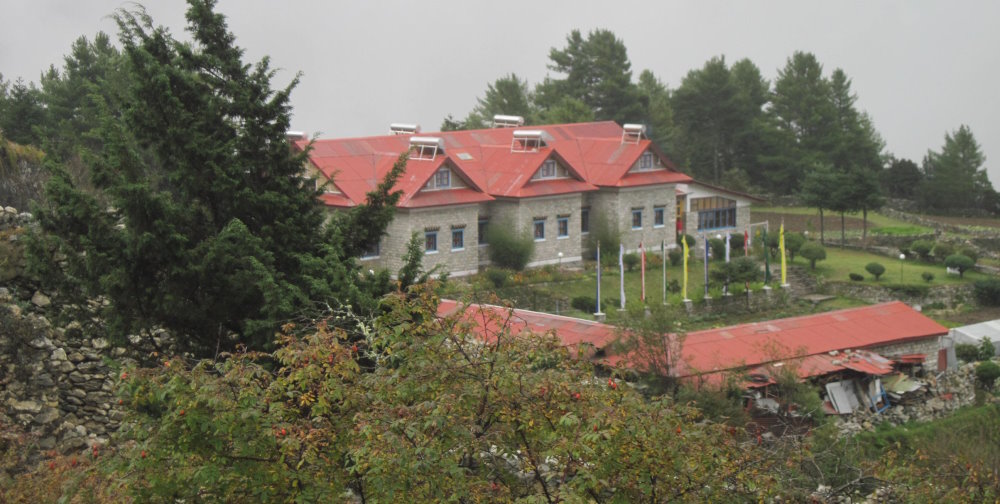
Because the available accommodations above Pangboche tend to be very basic, Adventure Consultants provides tented campsites for its “luxury trek” clients in Dingboche and beyond. What campsites they are! Mike and I each had a large private tent with LED lighting and a full-sized cot. The cots had thick foam mattresses, pillows and warm eiderdown sleeping bags. The tents were tall enough to stand up in without stooping. Chemical toilet facilities were conveniently close by. In addition, there was a huge dome tent for eating and socializing. It featured a table, chairs, gas heater, electric charging station and cabinets filled with assorted snacks and beverages available 24-hours a day. Finally, there was a fully-equipped cook tent manned by two cooks to produce our meals and a retinue of four “camp wranglers” to build and move camp whenever needed. The whole 10-man staff (including our two porters) was housed in tents within the camp compound.

After a delicious dinner in the dome tent, I mentioned to Mike that we would have to invent some stories to tell the folks back home about the terrible hardships we suffered on the trip…having to fight off a hungry snow leopard, getting caught in an avalanche, etc., etc. Mike immediately agreed to be in charge of the project, noting with irrefutable logic that he “was both a politician and a car salesman.”
Trek Day #7 (October 5):
Dingboche (14,123’ / 4,305m) Acclimatization Hike
Trekking distance: 4.2 miles / 6.8 km
Net altitude gain: 1,458’ / 444m
True hills climbed: 1,458’ / 444m
Hours on trail: 3:30:00
This morning I positively confirmed that I am not cut out to be an Everest Base Camp porter. After breakfast we bumped into Bobby and Kanchha as they were preparing to do a carry to our next camp in Lobuche. They had just loaded their traditional wicker baskets and were planning to do a drop-off and return in the same day. Bobby invited me to pick up his load. I am absolutely certain that weighed more than 100 pounds / 45kg. In response to my sputtering amazement, he calmly shouldered the load, smiled and went off on his way. Nepalese porters are made from stern stuff!
Our porters performed astonishing feats of strength every day.
Once again relying on his intimate knowledge of the region, Tsering scorned using the path that everybody else seemed to be taking for their acclimatization hikes. Instead we struck off for the mountains east of town. We climbed through high pasturelands populated with yaks and dzos (hybrids of the yak and cow) and the only people we saw were the folks who actually lived there. Yesterday, along the way to Dingboche, the trees finally disappeared and alpine meadows took their place. The land we now hiked over was grassy, crisscrossed with streams and anchored by lots of dense low bushes. It was a great experience to slowly gain altitude in such idyllic surroundings. After a couple of hours we hit a high point of over 15,500 feet / 4,725m. Satisfied with the day’s efforts, we turned around and headed back to camp.

He only cautionary note came from Mike. While he performed well, he said that he was very tired. He had developed the dreaded “Khumbu cough” and it was sapping his strength. The cough is caused by a combination of high altitude and low humidity. It disturbs the sleep at night and is a constant irritant during the day. It is one of the many things that makes being at altitude so very tough.
Trek Day #8 (October 6):
Dingboche (14,123’ / 4,305m) to Lobuche (16,207’ / 4,940m)
Trekking distance: 6 miles / 9.7 km
Net altitude gain: 2,084’ / 635m
True hills climbed: 2,664’ / 812m
Hours on trail: 5:00:00
I was excited to have Lobuche as the goal for the day’s trek because it has been years since I have been over 16,000 feet / 4,877m and I was anxious to test life in that lofty realm again. I also knew that we would be climbing the giant 800 vertical foot (244m) “Step” at Thukla and wondered how tough it would be. It is regarded by some as the crux of the Everest Base Camp Trek and I hoped that I would be up to the challenge.

After a walk through bustling Dingboche we took a well-trodden trail up to the array of chortens that preside over the town. The view of Dingboche was excellent but even better was the view of the route forward. You could see the trail unfolding before you as it weaves slowly upward though easy alpine fields. It was simple to pick out landmarks a mile distant and measure your progress toward them. Off to the left the town of Periche is visible, nestled in a valley 600 vertical feet (183m) below. It was hugely encouraging to be hiking in such ideal conditions and to see the miles disappearing under our feet.
The great Thukla Step is the crux of the Everest Base Camp Trek.
Things got exciting 3.5 miles / 5.7km into the trek when the trail plunged sharply downward to a boulder-choked watercourse that is at the bottom of the great Thukla Step. The rushing water is the outflow from the Khumbu Glacier that lies at Mt Everest’s foot. After cascading down the ravine next to the Thukla Step it flows into the valley where Periche sits and eventually feeds the mighty Imjha Khola River. A series of huge stone slabs allow you to cross the river without getting wet but then you are faced with the bitter reality of having to climb the Step. We were immediately reminded that it is very tough to climb a steep gradient at altitude. However, a saving grace is that there is a large teahouse a short distance from the bottom and we repaired there for hot chocolate and a snack. We had lots of company at the teahouse.

Life always seems better after a warm drink and we began the upward journey with renewed confidence. The trail up the Step is heavily switch-backed and very challenging because rocks are strewn everywhere and the underlayment loose and gravelly. It is unrelentingly steep. Everywhere on the ascent we saw hikers leaning over their trekking poles gasping for breath. Thankfully, Mike and I fared well. It took us less than an hour to reach the top and join the gaggle of other successful climbers lounging victoriously there. At the top there is an area containing memorial structures for climbers who have died on Mt Everest. Perhaps the most famous of these is Scott Fischer, the Mountain Madness head guide who died in the terrible 1996 storm recounted in Jon Krakauer’s book Into Thin Air. Another who died in the same storm was Adventure Consultants’ head guide Rob Hall. Hall’s memorial is further down the trail outside of Gorak Shep.

Once atop the Step it was an easy matter to hike the final 1.5 miles / 2.4km to Lobuche. The trail is sandy, gently rising and open enough to afford clear views of the road ahead. It is unmistakably in mountain territory because the only vegetation still clinging to life around us were clumps of tough bristly grass. Lobuche itself was a bit of a disappointment. It is a hardscrabble little village with few visible charms. I had expected it to be something of a garden-spot based on accounts of Everest climbers who retreated there for rest before embarking on their final assaults. I suppose that almost anything would look good after laboring for weeks on Everest’s life-threatening heights. In any event, we did not tarry long because our campsite was perched on a hilltop ten minutes beyond town. Upon reaching camp it was positively wonderful to sit down in the big dome tent and know that our work for the day was done. Our timing was impeccable as well because just as we reached camp a heavy hail began pelting the ground.
Trek Day #9 (October 7):
Lobuche (16,207’ / 4,940m) Acclimatization Hike
Trekking distance: 2.1 miles / 3.4 km
Net altitude gain: 255’ / 78m
True hills climbed: 255’ / 78m
Hours on trail: 2:00:00
Our careful acclimatization schedule had us stopping for an additional night at Lobuche before heading out to Gorak Shep. The only thing on the agenda was a short hike to the top of a rock ridge behind our camp. Once we mounted it the topography of the area became clear. The ridge was the lateral moraine of the Khumbu Glacier. We followed it for a mile north and could plainly see the hulking icy masses of Nuptse and Lhotse just 5 miles (8 km) away. From our vantage point on the ridge we could also see the route we would follow the next day towards Gorak Shep. It looked encouragingly straightforward.

My optimistic mood was tempered at dinner when Mike expressed concerns about tomorrow’s program. According to the plan, we would trek 2.9 miles / 4.7 km to Gorak Shep and climb Kala Patar (18,514’ / 5,643m) later that afternoon. Mike said that today’s acclimatization hike had set off alarm bells because he felt out of breath and very fatigued throughout it. He did not think that attempting Kala Patar would be possible for him. This was all very perplexing because he had climbed Kilimanjaro (19,341 feet / 5,895m) not long ago and had no problems at all reaching the summit there. Tsering came up with a sensible plan to deal with the situation. In a nutshell it was: “We will start early and go slow.” We agreed to meet for breakfast at 6am and begin hiking immediately thereafter.
Acclimatization always comes hard and sometimes times not at all.
Acclimatization is a notoriously finicky process that follows a clear set of rules except when it ignores all the rules completely. The best example of this comes in the person of Sir Edmund Hillary, Mt Everest’s first summiteer. A year after his brilliant success on Everest, Hillary returned to the Himalayas to tackle Makalu, the world’s fifth highest mountain. On that climb Hillary succumbed to altitude illness and came close to dying. By the time he was 58 years old his susceptibility to mountain sickness was so severe that he could not travel in the Khumbu at all.
There was no questioning Mike’s fitness: he was a multiple times Ironman Triathlon finisher with more Ironman finishes in his future. There was no questioning the soundness of the acclimatization program built into our trip: it was conservative and almost guaranteed success. More than anything else, Mike was the victim of bad luck.
Trek Day #10 (October 8):
Lobuche (16,207’ / 4,940m) to Gorak Shep (17,074’ / 5,204m)
Trekking distance: 2.9 miles / 4.7 km
Net altitude gain: 867’ / 264m
True hills climbed: 1,158’ / 353m
Hours on trail: 4:00:00
Kala Patar (18,514’ / 5,643m) Ascent
Distance round-trip: 2.2 miles / 3.5 km
Net altitude gain: 1,277’ / 389m
Time round-trip: 2:30:00
The ground was covered in snow when we started the trek to Gorak Shep and it was much colder than before, about 20°F / -7°C. For the first time on the trip I wore gloves. However, it was cheering that the first part of the journey was over the easy ground we surveyed yesterday. We stuck to our “Pole, Pole!” pacing plan and were tempted to think that we would have any easy time of it. Tsering knew different and told Mike and me to brace ourselves for the final mile into town. It was awful.

A glacier descends from Pumori’s western flank and collides with the Khumbu Glacier as the Everest Base Camp Trail nears Gorak Shep. It is impossible to get to Gorak Shep without going straight through the collision zone and conditions quickly become desperate. What starts out as a perfectly agreeable hiking trail is transformed into a maze of giant boulders riding on top of the warring glaciers. As the glaciers move the rocks move and icy channels appear out of nowhere. A path that works today might be obliterated tomorrow. All of this is a long way of saying that the final mile into Gorak Shep tried our patience and sapped our stamina. It was a rare example of the Everest Base Camp Trail descending into utter chaos. We were ever-so-grateful when we crested the last rise and saw the town a short distance ahead.

Our camp was located in a meadow a ten-minute walk above town. It was built to the same high standard as the ones in Dingboche and Lobuche and the “camp wrangler” crew was just putting the final touches on it when we arrived. Knowing that it is logistically impossible to move all the equipment of the “luxury” campsites from one place to the next during the trek, Adventure Consultants stores duplicate facilities in each town where we stay. While Nepalese porters are supermen, it made me feel a little less guilty to know that they did not have to do the impossible on our behalf.
We were ensconced in luxury in faraway Gorak Shep.
Mike did a great job toughing out the trek to Gorak Shep but it was obvious that he suffered quite a lot along the way. His labored breathing and persistent cough showed that the altitude was making his life miserable. Consequently, when it came time to saddle-up for the ascent of Kala Patar he made the wise decision to remain in camp. Accompanied by Sonam and Tsering I made the climb without him.

Kala Patar is a small (for the Himalayas!) rocky peak that sits in the shadow of the giant snowy Pumori massif. From our camp its looked almost like one sat on top of the other. What makes it a favorite with Everest Base Camp trekkers is that it affords stupendous views of Everest’s western ridge, Nuptse and the Khumbu Icefall. I had been longing to climb it for years and was thrilled that my opportunity had now finally come. From our campsite, getting to the start of the standard route was surprisingly difficult. It involved a long traverse over terrain so steep that I had to use a crampon-less version of French technique just to retain my footing. However, in due course we reached the standard trail and all problems disappeared.

The trail to the top of Kala Patar is a veritable king’s highway. It is perfectly distinct, switch-backed in all the right places and has a firm footing that makes for easy upward progress. We gained altitude with astonishing speed and it was not until the last 200 vertical feet (61m) that the trail finally yielded to a rubble-field guarding the summit. Progress on this section slowed to a crawl. The summit is crowned by an automated weather station and draped in weathered prayer flags. During the final part of the climb I looked up at these a thousand times and they got closer in depressingly tiny increments. However, within an hour and a half of leaving camp (2pm) we stood on Kala Patar’s 18,514 foot / 5,643m summit. As advertised, the views were magnificent. In addition, we had the place almost to ourselves. Only three other people were up there with us and we had found the trail to the summit virtually empty.

The trip back to camp took barely forty-five minutes. Even at high altitude, going downhill is no problem whatsoever. I was back in the dome tent enjoying a hot cup of coffee by 3:00 in the afternoon.
Trek Day #11 (October 9):
Everest Base Camp (17,598’ / 5,364m)
Distance round-trip: 4 miles / 6.5 km
Net altitude gain: 524’ / 160m
True hills climbed: 665’ / 203m
Time round-trip: 4:30:00
Today was a big day in more ways that one. Besides being the day we would trek the final distance to Everest Base Camp, it was Mike’s 67th birthday.
October 9, 2019: a big day in more ways than one!
We left camp at 7am. It was bitterly cold and snow covered the ground. We initially descended to the huge sandy plain outside Gorak Shep and saw legions of hikers moving across it. My heart dropped a bit because I thought that the trail would be choked with other trekkers. However, it quickly became clear that virtually everyone was heading toward Kala Patar. Proving once again the inestimable value of experience, Tsering knew that the vast majority of trekkers did Kala Patar in the morning and Base Camp the next afternoon. By reversing the schedule we were assured of relative solitude and a much more enjoyable trekking experience.

However, the word “enjoyable” might not best describe the final part of the hike. The trip is very difficult because the route is strewn with glacial debris and loaded with the same sort of obstacles we encountered on the approach to Gorak Shep. Progress was slow as we climbed steep gradients and inched our way down sharp descents. In some places we traversed across insecure catwalks with frightening drop-offs on our right side. The Khumbu Glacier was our constant companion and it became a terrifying presence as we neared Base Camp and the awful reality of the Icefall came into view.

The Khumbu Icefall is a wonder of nature and must be seen to be believed. The scale is immense and its hazards are starkly apparent. There is no disguising the danger of millions of tons of ice in a slow-motion cascade over the lip of a steep hill. It is unimaginable to me how this perilous disaster zone can be crossed scores of times every year by climbing parties. It is even more astounding that the pioneer reconnaissance parties who first saw the Icefall in 1950 and 1951 shrugged off the dangers and tapped it as a feasible road to the Western Cwm that lay beyond. Personally, I wanted no part of the Icefall and just seeing it made me uneasy.

We reached Everest Base Camp after two hours and forty minutes on the trail. It was wonderful to be able to sit and enjoy the successful completion of the journey. We knew we had arrived at the right place because someone had helpfully spray-painted “Everest Base Camp 5364m” on a nearby rock festooned with prayer flags. Located on a long strip of lateral moraine that borders the Khumbu Icefall, it validates the old real estate principle “Location, location, location.” For anyone wanting to climb Mt Everest, this is exactly where you want to be.

While I was feeling great, Mike was an altogether different story. His body was still stubbornly refusing to acclimatize and the meager 50% of sea-level-normal oxygen available at 17,598 feet / 5,364m pushed him toward hypoxia anytime he moved. It was a testament to his toughness that he soldiered on to the finish line. However, taking stock of his condition, Tsering broke out an oxygen bottle shortly after we arrived at Base Camp. Mike put on the mask and used supplemental oxygen all the way back to Gorak Shep. He later said that he was so breathless by the time he reached Everest Base Camp that he doubted that he could have made the return without oxygen. He was very grateful to Adventure Consultants for including oxygen in our expedition kit. Happily, by the time we reached our own campsite Mike was looking like his old self.

We gathered in the dome tent for a celebratory lunch and lo-and-behold, the cook produced a delicious chocolate birthday cake for Mike. Incredibly, the cake was the lesser wonder of our luncheon because the entrée was sushi. Sushi!!! How sushi ever came to the lofty precincts of Gorak Shep is a mystery that will endure forever.

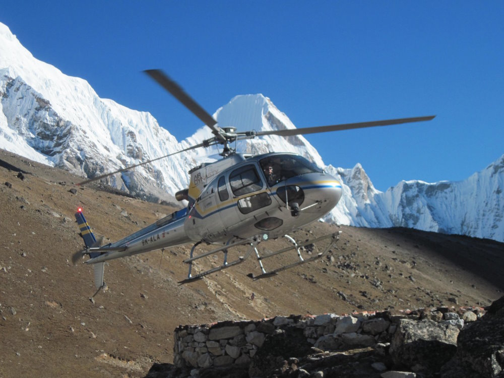
After lunch we got down to the business of discussing the return to Dingboche. Per the itinerary we would do the 8.9 mile / 14.4 km trek the next day. However, anticipating that the hike might pose an unreasonable risk his health, Mike had asked Tsering the night before to explore his evacuation options. There were two choices: horseback and helicopter. Naturally, the latter was the best option and Tsering scrambled to confirm the helicopter charter for 8am the next morning. In the 7-minute flight to Dingboche Mike would drop nearly 3,000 feet / 914m in altitude and by so doing give his body a strong push toward recovery.
Trek Day #12 (October 10):
Gorak Shep (17,074’ / 5,204m) to Dingboche (14,123’ / 4,305m)
Trekking distance: 8.9 miles / 14.4 km
Net altitude loss: -2,951’ / -899m
Hours on trail: 4:00:00
It was exciting to see the helicopter land at Gorak Shep’s rock-paved helipad and Mike, Sonam and Tenzing, our cook, quickly piled in. Giving the impression of limitless power the helicopter lifted off, pointed its nose down-valley and was gone leaving Tsering and me dusted in a little hurricane of kicked-up snow. It was a frigid but beautiful day for flying.
I was in high spirits as we set off for Dingboche. I felt uncommonly fit and basked in the knowledge that all my trip goals had been accomplished. We wove our way through the glacial collision zone outside of town with little difficulty and were soon on the easy trail to Lobuche. It seemed like a royal road to me. We stopped for more than an hour at a teahouse in Lobuche to enjoy a late breakfast there.
Tsering had no trouble at all keeping up.
Going down the great Thukla Step was a comparative pleasure and had as its highlight a chance meeting with Tsering’s father who happened to be driving a caravan of yaks up the hill. Small world!

All the way from Gorak Shep, Tsering let me take the lead and set the pace. After eleven days of “Pole, Pole!” it was hugely enjoyable to stretch my legs and profit from my successful acclimatization. Not surprisingly, Tsering had no problem at all keeping up. Before we knew it, we were at the chortens above town and could see our campsite far below.

As we walked through Dingboche, Tsering recognized an old acquaintance sitting in the entrance to his shop. He stopped to have a chat and introduced me to the man. After we left, Tsering explained that in his day the man was a famous mountaineer. He was credibly believed to have summited Mt Everest 24 times. Now past middle age, the man does not hold the “official” record for most ascents because during his halcyon years Sherpas paid little attention to documenting their climbs. It was sobering to think of this world-class mountaineering giant modestly living an anonymous life as a shopkeeper selling the same candy bars, toilet paper and bottled water to tourists as every other shopkeeper in town. My guess is that there are hundreds of former Olympic gold medal winners living in similar comfortable obscurity throughout the world.
Mike looked worlds better in Dingboche than in Gorak Shep. The fast return to lower altitude had worked a magical transformation. It was fun to lounge around camp with nothing more complicated to think about than “What’s for dinner?” At dinner the whole ten-man crew joined us in the dome tent to hear Mike’s and my heartfelt “Couldn’t have done it without you!” speeches and, on a more practical note, to receive their tips. Riding high on success, we were abundantly generous!
Trek Day #13 (October 11):
Dingboche (14,123’ / 4,305m)- Lukla – Kathmandu (4,386’ / 1,337m)
Net altitude loss: -9,737’ / -3,867m
We arrived at Dingboche’s modest little helipad at 7:30am hoping for a quick pick-up but the copter was delayed with rescue missions until 9am. While we waited, a pair of yaks browsed peacefully over the helipad. A significant chunk of the helicopter companies’ income comes from evacuations and these always take priority over other flights. In our two days at Gorak Shep I had been astounded by the amount of helicopter traffic in the air. The choppers were a constant presence and in the morning when the weather was most stable you could frequently look up to see four at one time. I have never been in so congested a helicopter corridor.

The flight to Lukla was unforgettably scenic and regrettably quick. Lukla is only 15 air miles (24 km) from Dingboche and the helicopter made laughably easy work of the distance. It dispatched our 6-day trek in just 10-minutes. Once in Lukla, more rescue missions trumped our plans to travel to Kathmandu but finally at 11am our ride returned. It was refueled manually from 5-gallon plastic jugs and we were shortly aloft for the 40-minute flight to Kathmandu. By 12:30pm we were safely back in the luxurious arms of the Yak & Yeti Hotel. It was sublimely wonderful to be back in the world of high-speed internet, central heat and cooling and indoor plumbing once again!
Return
After one extra day in Kathmandu (we had both factored a “weather contingency day” into our flight schedules) Mike and I went our separate routes back to the United States. Arriving home after two weeks in the Khumbu it was startling to see the forest of skyscrapers rising out of downtown Houston. It was even nicer to breathe the city’s warm, moist and generously oxygenated air. It was good to be home.
Final Thoughts
Everyone should go into the Khumbu at least once and there is no better way to experience it than on an Everest Base Camp Trek. You will experience firsthand the mightiest mountain range on Earth and see sights you will recall with genuine pleasure the rest of your life. Make no mistake: the Everest Base Camp Trek requires good physical preparation. Couch potatoes need not apply. Everybody who does it will have moments of profound fatigue, doubt and mental anguish about whether it was such a good idea to do the trek after all. But pain and self-doubt comprise the spicy sauce that makes completion of the trek so rewarding. No one who hikes the long road to Everest Base Camp will come away from the experience without the full measure of pride that comes from a job well done.
